ABOUT THIS BOOK
PUBLISHER: Collins
ISBN: 9780007229871
PAGES: 72 p.
PUBLICATION DATE:
February 1, 2007
BUY THIS BOOK
As an Amazon Associate and Bookshop.org affiliate we earn from qualifying purchases.
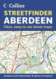
Collins Aberdeen Streetfinder Atlas
This work features maps at a scale of 4 inches to 1 mile. It covers a detailed street map of Aberdeen and the surrounding villages. As well as the clear, easy-to-use street maps, there is also a Local Information and Places of Interest section plus a road map of Aberdeenshire and Angus for route planning purposes. Main features include: full colour street atlas combining two different scales of mapping: detailed town centre maps at 4 inches to 1 mile and clear route planning maps of the area surrounding the city centre at 4 miles to 1 inch. It includes main street maps at 4 inches to 1 mile; Central Aberdeen at extra large 6.5 inches to 1 mile scale; local information section with important contacts and detail; road map at 4 miles to 1 inch, centred on Aberdeen, complete with full index; descriptions of places of interest within a 30 mile radius of the town centre. Street level map extends from the airport in the north to Newtonhill in the south and from Westhill in the west to the coast in the east. Road map extends from Fraserburgh in the north to Arbroath in the south.
ALSO ON BOOKS FROM SCOTLAND
-

David Robinson Reviews: From Scotland with Love by Fred Bridgland
‘There are so many unsung heroes in Fred’s book that I almost lose count.’
-

Winter Round Up of New Scots and Gaelic Books
‘what would happen if someone really scrieved in thir ane langwij / didn’t turn on their mouth lit i …
-

David Robinson Reviews: Blurred Faces by Allan Radcliffe
‘Radcliffe writes with an enviably economical and engaging style.’
-
Alfred Buckham: Daredevil Photographer
‘ALFRED BUCKHAM (1879–1956) was a daredevil photographer. A maverick of early aviation, he created h …
-

‘She is still walking but he has stopped. She turns to find that he is waiting for a response to som …
-
David Robinson Reviews: Upon a White Horse by Peter Ross
‘Ross is always lucid, almost reverent, about the whole process of archaeological discovery.’
FEATURED AUTHOR:
Peter May

Peter May is a novelist, originally from Glasgow but now living and working in France. He started out as a journalist, studying at the Edinburgh College of Commerce, and winning the Fraser Award aged just 21 for his writing. He was named Scotland’s You …
FEATURED PUBLISHER:
Witherby Publishing Group

Witherby Publishing Group was established in 2008, initially as Witherby Seamanship Limited, through a merger between Witherbys Publishing and Seamanship International Ltd. The Witherby business dates back to 1740 when Thomas Witherby opened a statione …