
ABOUT THIS BOOK
PUBLISHER: HarperCollins Publishers
FORMAT: Hardback
ISBN: 9780008115395
RRP: £8.99
PAGES: 48
PUBLICATION DATE:
May 21, 2015
BUY THIS BOOK
As an Amazon Associate and Bookshop.org affiliate we earn from qualifying purchases.
Collins Picture Atlas
Collins Maps
A beautifully illustrated picture atlas designed to take children on an exciting journey around the world. Each spread includes introductory text about the region. Pictorial symbols are used on clear, colourful background mapping to depict themes such as national emblems, customs, food, birds, animals, buildings, sports etc. to help younger readers gain an understanding of peoples around the world. Continental spreads focus on flags and the most important geographical facts e.g. well known highest, lowest, largest physical and demographic features. Additional Features: * A variety of activity based features accompany the mapping on each spread designed to encourage the reader to extract information from the map. * Fascinating facts about each country -presented in a fun way for each spread * Website links are listed to assist further study for the older child.
Collins Maps
Explore the world through accurate and up-to-date mapping.
ALSO ON BOOKS FROM SCOTLAND
-


David Robinson Interviews: Gavin Francis
‘He’s not my GP so I can’t say this for sure, but based on this book – wise, informed, well-written, …
-
The Cromarty Library Circle by Shona MacLean
‘No one in the room could have been unaware of what it was that Dr Fraser alluded to. The horrors pe …
-
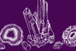
In Search of Gems by Kenneth Steven
‘It still amazes me that these magnificent shells grow in a river. Never mind whether they have pear …
-
Winterbourne by Elisabeth Wolf
‘The Coopers stared at each other for a second, two seconds. ‘It’s a sign—’ said Cooper.’
-
David Robinson Reviews: From Scotland with Love by Fred Bridgland
‘There are so many unsung heroes in Fred’s book that I almost lose count.’
-
Winter Round Up of New Scots and Gaelic Books
‘what would happen if someone really scrieved in thir ane langwij / didn’t turn on their mouth lit i …
FEATURED AUTHOR:
James Robertson

James Robertson was born in 1958 and grew up in Bridge of Allan, Stirlingshire. A poet, editor, novelist and publisher, he is an active and prolific writer, enjoying stints at Hugh MacDiarmid’s cottage, Brownsbank, near Biggar, Lanarkshire, and as the …
FEATURED PUBLISHER:
Orkneyology Press
We are a bibliophile husband and wife team, Tom and Rhonda Muir of the Okney Islands. Orkneyology Press evolved from our website, Orkneyology.com. Curating remarkable stories by means of an independent press has been our ultimate goal since we began th …