
ABOUT THIS BOOK
PUBLISHER: Birlinn General
FORMAT: Hardback
ISBN: 9781780274003
RRP: £30.00
PAGES: 272
PUBLICATION DATE:
November 10, 2016
BUY THIS BOOK
As an Amazon Associate and Bookshop.org affiliate we earn from qualifying purchases.
Oxford: Mapping the City
Daniel MacCannell
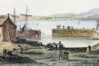
Over the past four and a half centuries, the magnificent city of Oxford has been mapped for many reasons, few of which have involved the mere finding of one’s way through the streets. Maps were produced as part of schemes to defend Oxford from rampaging Roundheads, raging floodwaters, and the ravages of cholera; to plan the new canals and bridges of the eighteenth century and the new railways, tramways and suburbs of the nineteenth; to determine and display changes in the city’s political stature under the Reform Acts of 1832 and 1867; to aid police enforcement of the laws against homosexuality; and even to plan a Soviet ground assault on the heart of the British motor industry. Given its status as a world centre of drama, poetry, literature, music, architecture, and scientific experimentation, and sometime royal capital, it is unsurprising that Oxford was the first British town to be included in map form in a tourist guidebook, as early as 1762, and one of just two inland towns mapped by French invasion planners in the Seven Years’ War.For the first time, this lavishly illustrated volume brings together sixty of the most remarkable maps and views of the area that have been made by friend and foe since 1575.
Daniel MacCannell
Daniel MacCannell lives in Bristol, where he runs the Historical Detective Agency Ltd. He has studied Scottish, English, Dutch andFrench buildings, landscapes and townscapes for more than twenty years, and was awarded a Ph.D. in History and Art History by the University of Aberdeen in 2010. His previous books include Edinburgh: Mapping the City and Understanding Scottish Buildings.
OTHER BOOKS BY THE SAME AUTHOR
ALSO ON BOOKS FROM SCOTLAND
-

David Robinson Reviews: The Loch of the Bees
‘The past’s current flows through the characters in his fiction so strongly that it almost becomes t …
-

The Nightkeeper’s Apprentice by Jude Reid
‘She’d never seen anything like it. The whole sky was lit up in ribbons of colour – blue, green, yel …
-

David Robinson Interviews: Gavin Francis
‘He’s not my GP so I can’t say this for sure, but based on this book – wise, informed, well-written, …
-
The Cromarty Library Circle by Shona MacLean
‘No one in the room could have been unaware of what it was that Dr Fraser alluded to. The horrors pe …
-

In Search of Gems by Kenneth Steven
‘It still amazes me that these magnificent shells grow in a river. Never mind whether they have pear …
-

Winterbourne by Elisabeth Wolf
‘The Coopers stared at each other for a second, two seconds. ‘It’s a sign—’ said Cooper.’
FEATURED AUTHOR:
CD Boyland

Born in the city of Coventry and now living near Glasgow, CD Boyland’s poems have been accepted or published by magazines and anthologies such as: 404Ink, Gutter, The North, The Poets’ Republic and New Writing Scotland. An innovative and exciting new v …
FEATURED PUBLISHER:
Royal Botanic Garden Edinburgh

The Royal Botanic Garden Edinburgh (RBGE) is a world renowned centre for plant research, conservation and education. Our four Gardens are also popular visitor attractions, offering fun and inspiring events for adults and children. The RBGE Publications …