
ABOUT THIS BOOK
PUBLISHER: HarperCollins Publishers
FORMAT: DVD-ROM
ISBN: 9780008241414
RRP: £60.00
PUBLICATION DATE:
February 9, 2017
BUY THIS BOOK
As an Amazon Associate and Bookshop.org affiliate we earn from qualifying purchases.
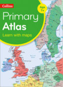
Primary Educational Atlases: Collins Primary Atlas – Whiteboard Edition
Collins Maps
Collins Whiteboard Atlases make geography lessons more interesting and get the whole-class to participate. The ‘big book’ format enables you to work with all your students together, manipulating images and focusing on specific areas of study. The interactive format will help you and your pupils get the most from your atlas. Collins Primary world Atlas presented on CD ROM for use on digital Whiteboards. 64 pages providing an introduction to mapping of the UK, Europe and major regions of the world. Map skills section introduces map reading skills and a guide to using the atlas. All reference maps are politically coloured clearly identifying country outlines. National flags of countries mapped on each spread are included. Printable blank outline maps of the continents and the world are included to support classroom activities. Key Features and Benefits of Collins Whiteboard Atlases: * Improves understanding of new concepts * Increases pupil motivation and involvement * Helps with the planning, pace and flow of lessons
Collins Maps
Explore the world through accurate and up-to-date mapping.
OTHER BOOKS BY THE SAME AUTHOR
ALSO ON BOOKS FROM SCOTLAND
-

David Robinson Reviews: The Loch of the Bees
‘The past’s current flows through the characters in his fiction so strongly that it almost becomes t …
-

The Nightkeeper’s Apprentice by Jude Reid
‘She’d never seen anything like it. The whole sky was lit up in ribbons of colour – blue, green, yel …
-

David Robinson Interviews: Gavin Francis
‘He’s not my GP so I can’t say this for sure, but based on this book – wise, informed, well-written, …
-
The Cromarty Library Circle by Shona MacLean
‘No one in the room could have been unaware of what it was that Dr Fraser alluded to. The horrors pe …
-

In Search of Gems by Kenneth Steven
‘It still amazes me that these magnificent shells grow in a river. Never mind whether they have pear …
-

Winterbourne by Elisabeth Wolf
‘The Coopers stared at each other for a second, two seconds. ‘It’s a sign—’ said Cooper.’
FEATURED AUTHOR:
Shola von Reinhold

Shola von Reinhold is a Scottish socialite and writer. Shola has been published in the Cambridge Literary Review, The Stockholm Review, was Cove Park’s Scottish Emerging Writer 2018 and recently won a Dewar Award for Literature. Shola is a recent gradu …
FEATURED PUBLISHER:
DC Thomson Media
DC Thomson is one of the leading media organisations in the UK. Our headquarters are in Dundee but we also have offices in Glasgow, Aberdeen and London – in the world-famous Fleet Street. We publish newspapers, magazines and have diversified into new m …