ABOUT THIS BOOK
PUBLISHER: Cicerone Press
FORMAT: Electronic book text
ISBN: 9781783624195
RRP: £7.95
PUBLICATION DATE:
November 30, 2016
BUY THIS BOOK
As an Amazon Associate and Bookshop.org affiliate we earn from qualifying purchases.
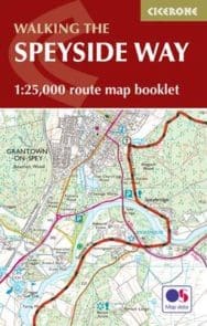
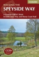
The Speyside Way Map Booklet: 1:25,000 OS Route Mapping
Alan Castle
All the mapping you need to complete Scotland’s 66-mile (106km) Speyside Way, an official Scottish Long Distance Route which follows the River Spey through northern Scotland from Aviemore to the old port of Buckie on the Moray coast. As well as beautiful scenery, the Spey is famed for its salmon and its distilleries. The route features easy walking on good paths and along disused railway lines and can be comfortably completed in a week. This booklet of Ordnance Survey 1:25,000 Explorer maps has been designed for convenient use on the trail and can be used when walking the route in either direction. It shows the line of the Speyside Way along with the relevant extract from the OS Explorer map legend. It is conveniently sized for slipping into a jacket pocket or top of a rucksack and comes in a clear PVC sleeve.NOTE An accompanying Cicerone guidebook – The Speyside Way / ISBN 9781852848682 – describes the full route from Aviemore to Buckie with lots of other practical and background information, for those preferring a written guide. The accompanying guidebook INCLUDES a copy of this map booklet.
Alan Castle
Alan Castle has trekked and cycled in over 30 countries within Europe, Asia, North and South America, Africa and Australasia. A member of the Outdoor Writers and Photographers Guild, he has written 18 guidebooks, several on long-distance mountain routes in France. An erstwhile national secretary and long-distance path information officer of the Long Distance Walkers Association, Alan now lives at the foot of the Moffat Hills in Scotland.
ALSO ON BOOKS FROM SCOTLAND
-

David Robinson Reviews: The Loch of the Bees
‘The past’s current flows through the characters in his fiction so strongly that it almost becomes t …
-

The Nightkeeper’s Apprentice by Jude Reid
‘She’d never seen anything like it. The whole sky was lit up in ribbons of colour – blue, green, yel …
-

David Robinson Interviews: Gavin Francis
‘He’s not my GP so I can’t say this for sure, but based on this book – wise, informed, well-written, …
-
The Cromarty Library Circle by Shona MacLean
‘No one in the room could have been unaware of what it was that Dr Fraser alluded to. The horrors pe …
-

In Search of Gems by Kenneth Steven
‘It still amazes me that these magnificent shells grow in a river. Never mind whether they have pear …
-

Winterbourne by Elisabeth Wolf
‘The Coopers stared at each other for a second, two seconds. ‘It’s a sign—’ said Cooper.’
FEATURED AUTHOR:
Anna Groundwater

Anna Groundwater is currently the Principal Curator for Renaissance and Early Modern History at the National Museum of Scotland. She previously lectured in early modern Scottish and British History at the University of Edinburgh. She’s the author of wo …
FEATURED PUBLISHER:
Leamington Books

Leamington Books publishes a variety of fiction and non-fiction titles under our ethos, Transformative Publishing. Our authors are chosen for their undiscovered talents, unique perspectives and one-of-a-kind stories to tell. Leamington’s work is driven …