ABOUT THIS BOOK
PUBLISHER: Cicerone Press
ISBN: 9781852841218
PAGES: 142p.
BUY THIS BOOK
As an Amazon Associate and Bookshop.org affiliate we earn from qualifying purchases.
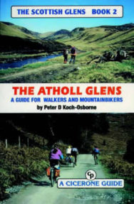
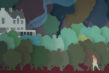
The Atholl Glens
The aim in this series of books is to provide the mountainbiker and walker with information on a variety of routes so they know something of what to expect. One of the problems is that O.S. maps give no indication as to whether an ‘other road’ is metalled, a path or a forest fire break, or anything in between. Many bridges shown on O.S. maps do not exist. Rivers are difficult to judge in size from the map, and a building may be anything from a pile of stones to a maintained bothy. All is revealed without removing the sense of adventure and exploration. Gradient profiles help to assess how strenuous a route is, and each hand-drawn page contains a wealth of information. The object is to save wasted leisure time and enable the armchair explorer to plan ahead or relive experiences. “The Atholl Glens” includes: The Glens East of Drumochter, Glen Tilt to Cairnwell, and Aberfeldy to Dunkeld.
ALSO ON BOOKS FROM SCOTLAND
-

David Robinson Reviews: From Scotland with Love by Fred Bridgland
‘There are so many unsung heroes in Fred’s book that I almost lose count.’
-
Winter Round Up of New Scots and Gaelic Books
‘what would happen if someone really scrieved in thir ane langwij / didn’t turn on their mouth lit i …
-

David Robinson Reviews: Blurred Faces by Allan Radcliffe
‘Radcliffe writes with an enviably economical and engaging style.’
-
Alfred Buckham: Daredevil Photographer
‘ALFRED BUCKHAM (1879–1956) was a daredevil photographer. A maverick of early aviation, he created h …
-
‘She is still walking but he has stopped. She turns to find that he is waiting for a response to som …
-
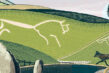
David Robinson Reviews: Upon a White Horse by Peter Ross
‘Ross is always lucid, almost reverent, about the whole process of archaeological discovery.’
FEATURED AUTHOR:
Mark Mechan

Mark Mechan grew up in Broughty Ferry with his mum and dad, and is the youngest of four siblings — two sisters and a brother. He went to Forthill Primary and Dundee High, then to Duncan of Jordanstone College of Art in 1988 where he studied Drawing …