ABOUT THIS BOOK
PUBLISHER: Birlinn General
FORMAT: Hardback
ISBN: 9781780273518
RRP: £30.00
PAGES: 288
PUBLICATION DATE:
October 6, 2016
BUY THIS BOOK
As an Amazon Associate and Bookshop.org affiliate we earn from qualifying purchases.
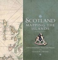
Scotland: Mapping the Islands
Christopher Fleet
Margaret Wilkes
Charles W. J. Withers
As miniature worlds, beautiful locations and homes to communities seemingly distant from the stresses of modern life, Scotland’s many islands have an extraordinary fascination on countless people, not least on the hundreds of thousands of visitors who visit them each year. Maps too fascinate, as objects of visual delight and historical importance, and as a means to represent and understand landscapes. This stimulating and informative book reproduces some of the most beautiful and historically significant maps from the National Library of Scotland’s magnificent collection in order to explore the many dimensions of island life and how this has changed over time. Arranged thematically and covering topics such as population, place-names, defence, civic improvement, natural resources, navigation, and leisure and tourism, Scotland: Mapping the Islands presents the rich and diverse story of Scottish islands from the earliest maps to the most up-to date techniques of digital mapping in a unique and imaginative way.
Christopher Fleet
Christopher Fleet is Senior Map Curator in the National Library of Scotland with particular responsibilities for digital mapping. Margaret Wilkes is a member of the Steering Committee of the Scottish Maps Forum, a Director of the Royal Scottish Geographical Society and Joint Chair of the Edinburgh Centre of the RSGS. Charles W.J. Withers is Ogilvie Chair of Geography at Edinburgh University and Geographer Royal in Scotland.
ALSO ON BOOKS FROM SCOTLAND
-


Shadow of Madness: A Q & A with D. V. Bishop
‘Yet a great novel of historical fiction also has us escape the here and now by immersing us in the …
-

‘I don’t think I decided to become a writer. I just was.’
-

Lessons From Scottish Schools: A Q & A with Lindsay Paterson
Ten years will not be enough to restore Scotland to where it was in the past…
-

Saltwater: A Midsummer Ghost Story by Elaine Thomson
‘The very thought of those grey faces made my skin grow cold.’
-

‘An Odious Campaign’ by Rob McInroy – Why a 1936 By-Election Still Resonates
‘This enraged the locals and he came close to being run out of town on several occasions.’
-

‘‘That’s right, Bobby,’ he growled. ‘I haven’t seen you in – well, since you decided to kill me.’ ‘
FEATURED AUTHOR:
Todd Westbrook

Todd is a writer lucky enough to have appeared in newspapers, magazines, agencies and online outlets in a number of countries and across a wide range of subject areas. His first book, the non-fiction work Revolution, was published in October 2020. He f …
FEATURED PUBLISHER:
Jasami Publishing Ltd
Jasami Publishing & Productions CIC takes talented new writers on the journey to becoming published authors. By publishing a myriad of genres Jasami offers a stellar variety from contemporary writers; From Scotland these include a crime writer, poe …