ABOUT THIS BOOK
PUBLISHER: HarperCollins Publishers
FORMAT: Spiral bound
ISBN: 9780007555109
RRP: £4.99
PAGES: 80
PUBLICATION DATE:
June 19, 2014
BUY THIS BOOK
As an Amazon Associate and Bookshop.org affiliate we earn from qualifying purchases.
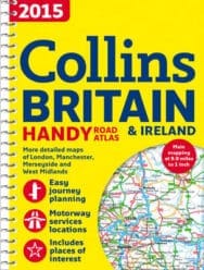
2015 Collins Handy Road Atlas Britain
Collins Maps
This easy-to-use, handy A5 sized road atlas with popular lie-flat spiral binding features extremely clear route planning maps of Britain and Ireland. A back up to your sat-nav or mobile phone and great for showing an overview of your journey. The maps of Britain are at 9.9 miles to 1 inch (1:625,000) and the whole of Ireland is covered at 15.8 miles to 1 inch (1:1,000,000). There are also a selection of more detailed urban area maps at 4.5 miles to 1 inch (1:285,000) to aid route planning in these busy areas. The atlas includes: * Road maps that focus on the main roads, motorways and settlements. * More detailed maps of London, Manchester, Merseyside and West Midlands. * Park & Ride locations (for bus and rail). * Handy distance calculator chart highlighting distances between the major towns.
Collins Maps
Explore the world through accurate and up-to-date mapping.
ALSO ON BOOKS FROM SCOTLAND
-


‘I don’t think I decided to become a writer. I just was.’
-

Lessons From Scottish Schools: A Q & A with Lindsay Paterson
Ten years will not be enough to restore Scotland to where it was in the past…
-

Saltwater: A Midsummer Ghost Story by Elaine Thomson
‘The very thought of those grey faces made my skin grow cold.’
-

‘An Odious Campaign’ by Rob McInroy – Why a 1936 By-Election Still Resonates
‘This enraged the locals and he came close to being run out of town on several occasions.’
-

‘‘That’s right, Bobby,’ he growled. ‘I haven’t seen you in – well, since you decided to kill me.’ ‘
-

David Robinson Reviews: Solitary Agents by David Goodman
‘This is very much an up-to-the-minute story of spycraft, positively revelling in all the things tha …
FEATURED AUTHOR:
Leonie Charlton

Leonie Charlton travelled extensively as a child, living in England, Africa, Wales and Scotland. She has worked as a cowgirl in Australia, an English teacher in Japan, and her degree in Hispanic Studies took her to Catalonia for two years. Marram, publ …
FEATURED PUBLISHER:
Royal Botanic Garden Edinburgh
The Royal Botanic Garden Edinburgh (RBGE) is a world renowned centre for plant research, conservation and education. Our four Gardens are also popular visitor attractions, offering fun and inspiring events for adults and children. The RBGE Publications …