ABOUT THIS BOOK
PUBLISHER: HarperCollins Publishers
FORMAT: Spiral bound
ISBN: 9780008102319
RRP: £4.99
PAGES: 80
PUBLICATION DATE:
June 18, 2015
BUY THIS BOOK
As an Amazon Associate and Bookshop.org affiliate we earn from qualifying purchases.
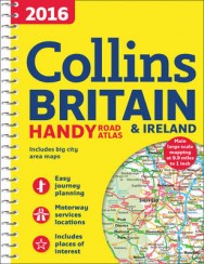
2016 Collins Handy Road Atlas Britain
Collins Maps
This easy-to-use, handy A5 sized road atlas with popular lie-flat spiral binding features extremely clear route planning maps of Britain and Ireland and fits neatly into your glove box, briefcase or bag. The atlas has been fully updated for 2016. The maps of Britain are at 9.9 miles to 1 inch (1:625,000) and the whole of Ireland is covered at 15.8 miles to 1 inch (1:1,000,000). There are also a selection of more detailed urban area maps at 4.5 miles to 1 inch (1:285,000) to aid route planning in these busy areas. The atlas includes: * Road maps that focus on the main roads, motorways and settlements. * More detailed maps of London, Manchester, Merseyside and West Midlands. * Park & Ride locations (for bus and rail). * Handy distance calculator chart highlighting distances between the major towns.
Collins Maps
Explore the world through accurate and up-to-date mapping.
ALSO ON BOOKS FROM SCOTLAND
-


‘I don’t think I decided to become a writer. I just was.’
-

Lessons From Scottish Schools: A Q & A with Lindsay Paterson
Ten years will not be enough to restore Scotland to where it was in the past…
-

Saltwater: A Midsummer Ghost Story by Elaine Thomson
‘The very thought of those grey faces made my skin grow cold.’
-

‘An Odious Campaign’ by Rob McInroy – Why a 1936 By-Election Still Resonates
‘This enraged the locals and he came close to being run out of town on several occasions.’
-

‘‘That’s right, Bobby,’ he growled. ‘I haven’t seen you in – well, since you decided to kill me.’ ‘
-

David Robinson Reviews: Solitary Agents by David Goodman
‘This is very much an up-to-the-minute story of spycraft, positively revelling in all the things tha …
FEATURED AUTHOR:
Metaphrog

Metaphrog are Franco-Scottish duo Sandra Marrs and John Chalmers, winners of The Sunday Herald Scottish Culture Awards 2016 Best Visual Artist. The Red Shoes and Other Tales and their Louis graphic novels are highly acclaimed internationally, and have …