ABOUT THIS BOOK
PUBLISHER: Octopus Publishing Group
FORMAT: Paperback
ISBN: 9780540086740
RRP: £9.99
PAGES: 192
PUBLICATION DATE:
February 28, 2005
BUY THIS BOOK
As an Amazon Associate and Bookshop.org affiliate we earn from qualifying purchases.
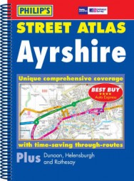
Philip’s Street Atlas Ayrshire: North, East and South
New, and the only detailed colour atlas of that gives comprehensive coverage of North, East and South Ayrshire.The mapping is based on Ordnance Survey data and gives the user complete coverage of all urban and rural areas. The main mapping is at a scale of 3 1/2 inches to 1 mile (2 2/3 inches to 1 mile in the pocket edition), with less populated areas mapped at 134 inches to 1 mile (1 1/3 inches to 1 mile in the pocket edition). Postcode boundaries are shown throughout.The atlas is ideally suited for both business and leisure use. There is a route-planning map at the front of the atlas. The street maps show every named road, street and lane, with through-routes highlighted in urban areas. School locations are marked and emergency services, hospitals, police stations, car parks and rail and bus station locations are all featured. There is a comprehensive index of street names and postcodes including schools, industrial estates, hospitals, sports centres, etc. These are highlighted in red.Main map scale: 3.5 inches to 1 mile and 1.75 inches to 1 mile
Reviews of Philip’s Street Atlas Ayrshire: North, East and South
'Best Buy' *****AUTO EXPRESS
ALSO ON BOOKS FROM SCOTLAND
-


Lessons From Scottish Schools: A Q & A with Lindsay Paterson
Ten years will not be enough to restore Scotland to where it was in the past…
-

Saltwater: A Midsummer Ghost Story by Elaine Thomson
‘The very thought of those grey faces made my skin grow cold.’
-

‘An Odious Campaign’ by Rob McInroy – Why a 1936 By-Election Still Resonates
‘This enraged the locals and he came close to being run out of town on several occasions.’
-

‘‘That’s right, Bobby,’ he growled. ‘I haven’t seen you in – well, since you decided to kill me.’ ‘
-

David Robinson Reviews: Solitary Agents by David Goodman
‘This is very much an up-to-the-minute story of spycraft, positively revelling in all the things tha …
-

The Savage Landscape by Cal Flyn
‘It is their resistance to the intrusions of the outside world − culturally, economically, environme …
FEATURED AUTHOR:
Evelyn Clarke

It was a dark and stormy night (well, it was actually an unusually warm evening in Edinburgh, Scotland) when Number One Sunday Times bestselling author V.E. Schwab, known for The Invisible Life of Addie LaRue and Bury Our Bones in the Midnight Soil, pr …
FEATURED PUBLISHER:
Glasgow Museums

We have a long history of publishing – Kelvingrove Art Gallery and Museum opened in 1901, and people have been writing about and publishing on the city’s collections ever since. The focus of Glasgow Museums Publishing programme is naturally the one mil …