ABOUT THIS BOOK
PUBLISHER: HarperCollins Publishers
FORMAT: Paperback
ISBN: 9780008146757
RRP: £7.99
PAGES: 68
PUBLICATION DATE:
December 31, 2015
BUY THIS BOOK
As an Amazon Associate and Bookshop.org affiliate we earn from qualifying purchases.
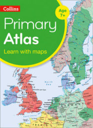
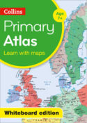
Collins Primary Atlas
Collins Maps
A curriculum-supportive Primary World Atlas for children aged 7-11 years (Key Stage 2). Designed for use in the classroom or at home, this revised edition includes informative politically coloured reference mapping of all major world regions. * This primary atlas provides an introduction to mapping of the UK, Europe and all major regions of the world. It includes information on map reading skills, the meaning of scale and measuring distances. * The reference maps are informative, politically coloured, and easy to read with national capitals and major cities easily identifiable. The maps are supported with national flags and basic national statistics. * Continental maps are linked to the regional mapping and are supported by a selection of aerial and terrestrial photographs. Continental relief maps show layer colouring and major physical features are highlighted. * The index uses a simple grid reference system and a selection of web addresses is included to help with further study.
Collins Maps
Explore the world through accurate and up-to-date mapping.
ALSO ON BOOKS FROM SCOTLAND
-


‘An Odious Campaign’ by Rob McInroy – Why a 1936 By-Election Still Resonates
‘This enraged the locals and he came close to being run out of town on several occasions.’
-

‘‘That’s right, Bobby,’ he growled. ‘I haven’t seen you in – well, since you decided to kill me.’ ‘
-

David Robinson Reviews: Solitary Agents by David Goodman
‘This is very much an up-to-the-minute story of spycraft, positively revelling in all the things tha …
-

The Savage Landscape by Cal Flyn
‘It is their resistance to the intrusions of the outside world − culturally, economically, environme …
-

The Shortest History of Scotland: A Q & A with Murray Pittock
‘We need to be better aware of that to understand the challenges and achievements of the past, and t …
-

David Robinson Interviews: John Lister-Kaye
‘I enjoy stillness. It creeps up on you and becomes almost a force. I’ve had squirrels run over my f …
FEATURED AUTHOR:
James Yorkston

James Yorkston is a singer-songwriter and author from the East Neuk of Fife, Scotland. Since signing to Domino Records in 2001, James has released a steady flow of highly acclaimed, multi-instrument, acoustic based albums. James’ 2021 album The Wide, W …
FEATURED PUBLISHER:
Lexus

Lexus started up in 1980, some years before the car. The company was founded by a group of bilingual lexicographers who had learned their trade in the bilingual dictionary department of Collins Publishers. At first Lexus was a packager and created a wi …