ABOUT THIS BOOK
PUBLISHER: Octopus Publishing Group
FORMAT: Spiral bound
ISBN: 9780540079001
RRP: £10.99
PAGES: 192
PUBLICATION DATE:
August 7, 2000
BUY THIS BOOK
As an Amazon Associate and Bookshop.org affiliate we earn from qualifying purchases.
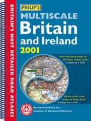
Philip’s Multiscale Britain and Ireland 2001
Sterling Publishing Company
George Philip & Son
Where do you want to go in England, Scotland, Wales, and Ireland? No matter the city or town, with this guide you’ll reach your destination with no trouble at all. It’s Britain’s most detailed road atlas, with ultra large-scale maps that cover all major urban areas; smaller road maps complete with a route-finding systems; and 60 town plans that point out one-way streets as well as places of interest. There’s even help in planning your itinerary ahead of time, and a distance table. From Aberdeen to London, Londonderry to Liverpool, Cardiff to Canterbury, even the Isle of Wight, here’s the way to get there and find your way around, full speed ahead.
ALSO ON BOOKS FROM SCOTLAND
-


Lessons From Scottish Schools: A Q & A with Lindsay Paterson
Ten years will not be enough to restore Scotland to where it was in the past…
-

Saltwater: A Midsummer Ghost Story by Elaine Thomson
‘The very thought of those grey faces made my skin grow cold.’
-

‘An Odious Campaign’ by Rob McInroy – Why a 1936 By-Election Still Resonates
‘This enraged the locals and he came close to being run out of town on several occasions.’
-

‘‘That’s right, Bobby,’ he growled. ‘I haven’t seen you in – well, since you decided to kill me.’ ‘
-

David Robinson Reviews: Solitary Agents by David Goodman
‘This is very much an up-to-the-minute story of spycraft, positively revelling in all the things tha …
-

The Savage Landscape by Cal Flyn
‘It is their resistance to the intrusions of the outside world − culturally, economically, environme …
FEATURED AUTHOR:
Anna Groundwater

Anna Groundwater is currently the Principal Curator for Renaissance and Early Modern History at the National Museum of Scotland. She previously lectured in early modern Scottish and British History at the University of Edinburgh. She’s the author of wo …
FEATURED PUBLISHER:
Scottish Mountaineering Press

Launched in 2020, the Scottish Mountaineering Press exists to promote and share Scotland’s natural wonders, embracing the creativity born out of an explorer spirit and celebrating the joy and endeavour in a life lived outdoors. We are a wholly-owned su …