ABOUT THIS BOOK
PUBLISHER: Philip's
ISBN: 9780540088324
PAGES: 204 p.
BUY THIS BOOK
As an Amazon Associate and Bookshop.org affiliate we earn from qualifying purchases.
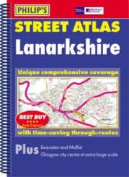
Lanarkshire
THE ATLAS Brand new, and the only detailed colour atlas of Lanarkshire that gives comprehensive coverage of the region. No other atlas shows every street in Lanarkshire. The mapping is based on Ordnance Survey data and gives the user complete coverage of all urban and rural areas. The mapping is at a standard scale of 31/2 inches to 1 mile (22/3 inches to 1 mile in the pocket edition) from Carron Valley Forest in the north to Lesmahagow in the south, including Glasgow City and North Lanarkshire. Smaller scale mapping at less than or equal to 1 inches to 1 mile (11/3 inches to 1 mile in the pocket edition) covers South Lanarkshire to the south of Lanark. All mapping is complete with postcode boundaries. The atlas is ideally suited for both business and leisure use. There is a route-planning map at the front of the atlas. The main maps show every named road, street and lane clearly with through-routes highlighted. School locations are marked and emergency services, hospitals, police stations, car parks and rail and bus station locations are all featured. There is a comprehensive index of street names and postcodes including schools, industrial estates, hospitals, sports centres, etc.These are highlighted in red.
ALSO ON BOOKS FROM SCOTLAND
-


Lessons From Scottish Schools: A Q & A with Lindsay Paterson
Ten years will not be enough to restore Scotland to where it was in the past…
-

Saltwater: A Midsummer Ghost Story by Elaine Thomson
‘The very thought of those grey faces made my skin grow cold.’
-

‘An Odious Campaign’ by Rob McInroy – Why a 1936 By-Election Still Resonates
‘This enraged the locals and he came close to being run out of town on several occasions.’
-

‘‘That’s right, Bobby,’ he growled. ‘I haven’t seen you in – well, since you decided to kill me.’ ‘
-

David Robinson Reviews: Solitary Agents by David Goodman
‘This is very much an up-to-the-minute story of spycraft, positively revelling in all the things tha …
-

The Savage Landscape by Cal Flyn
‘It is their resistance to the intrusions of the outside world − culturally, economically, environme …
FEATURED AUTHOR:
Leonie Charlton

Leonie Charlton travelled extensively as a child, living in England, Africa, Wales and Scotland. She has worked as a cowgirl in Australia, an English teacher in Japan, and her degree in Hispanic Studies took her to Catalonia for two years. Marram, publ …
FEATURED PUBLISHER:
Main Point Books

Main Point Books was established in 2023 by Jennie Renton and Madeleine Mankey as a publisher of alternative poetry. As publishing freelancers, Maddie and Jennie sought to pool their skills and expertise to bring projects that excite them to life. Base …